Machame Route
Overview
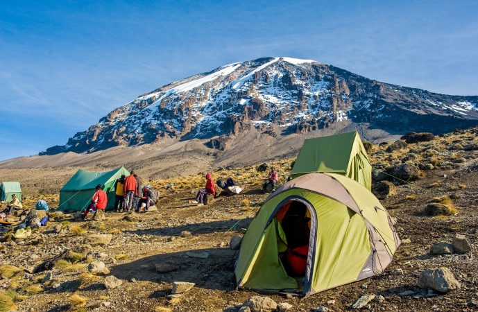
The Machame route is also known as the Whiskey route, given its reputation for being a tough climb, in contrast to the easier Marangu route, which is known as the Coca Cola route. Unlike the gradual incline and hut accomodations found on the Marangu Route, the climbers on Machame hike steeper trails, for longer distances, while sleeping in tents.
The Machame Route climb can be done in a minimum of six days (five nights) on the mountain. However, it is most often tackled over seven days (six nights), for a better altitude acclimatization schedule. The trek begins at Machame Gate, located in the southern base of mountain, within its lush, fertile rainforest.
The route heads toward the Shira Plateau, before circling along the southern circuit halfway around the mountain, exposing the climber to great views from all angles. The approach to the summit is made from the east, and the descent follows the Mweka trail.
Mount Kilimanjaro
Elevation 5895m
Location Tanzania, Africa
Number of Climbers 25,000 Annually
DAY 1
A one hour drive from Moshi lays to the Machame route, where we complete park formalities, meet our crew of porters and start to climb! The first section of the route climbs steadily and involves real jungle bashing through magnificent forest. This path is less well-trodden and it is often wet and muddy underfoot. We camp at Machame camp 3100 m
Trekking Time:4-6 hours /Distance: 9 km / Altitude gain: 1210 m
DAY 2
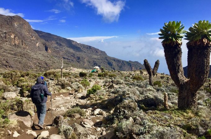
The route continues on up through the forest until we are the steep ascent on the Shira Plateau, where are rewarding view of the mountain. Looking back, you will be able to see Mt. Meru rising high above Arusha town. We camp at Shira caves at 3840 m
Trekking Time: 4-6 hours / Distance: 9 km / Altitude gain: 740m
DAY 3
Walking now on high moorland, the landscape changes the entire character of the trek. We traverse the south west side of Kilimanjaro, passing underneath the Lava Tower and the final section of the Western Breach and finally reach camp at Baranco camp 3900m the day has been spent at altitude up to 4600m, but we have followed the mountaineering code of walk high sleep low to avoid altitude sickness by aiding our bodies in acclimatization.
Trekking Time: 6-7 hours /Distance: 15km/ Altitude gain: 700m
DAY 4
We start the day by descending into the start of the Great Barranco, a huge ravine. We exit steeply, up what has been termed the breakfast Wall which divides us from the southeastern slopes of Kibo. Its is a climb over rocks ,not technical but long and tiring. Passing underneath the Heim and Kersten glaciers, we head towards the Karanga Valley 4000 m for lunch.
After lunch we continue the short hike on terrain formed by scree. We walk through arid and desolate land towards Barafu camp 4600 m
Trekking Time: 5-7 hours /Distance: 9 km /Altitude Gain: 700m /Altitude Loss 700 m
DAY 5
We avoid walking too long in the heat of the sun today by starting midnight steeply upwards to the summit glaciers. You will be climb scree for 5 hours, but gain incredible height over a short distance. The views of the spectacular ice cliffs within the crater rim at Stell Point 5750 m as the first rays of the sun emerge are amazing. Spectacular ice cliffs within the crater surround us and the views to Mawenzi peak and beyond are breathtaking. Another hours walk takes us to our goal, the summit of Uhuru 5895 the highest point, Uhuru means freedom in swahili.
Trekking Time: 6-8 hours / Distance: 7 km / Altitude Loss: 1296 m
We begin the descent by returning to Stella Point and then descending on scree slopes back to Barafu camp for breafast and rest before finally heading down to Millenium Camp 3800 for a well-earned rest. On our descent we have fabolous views of the plains and Mawenzi peak.
Trekking Time: 6-14 hours /Distance: 12km / Altitude Loss:2896 m
DAY 6
A gentle trek takes us down through the rainforest to the Mweka Gate 1640 m where we complete park formalities, are met by our vehicles,receive your certificate of ascent courtesy of the earned shower and a cold beer or two
Trekking Time 4-5 hours / Distance:10 km /Altitude Loss: 1360 m


