Lemosho Route

The Lemosho Route is widely considered to be the best route on Mount Kilimanjaro. Not too long ago, there were only two main routes used to climb Kilimanjaro – the Marangu (Coca Cola) route and the Machame (Whiskey) route. But as Tanzania’s tourism industry flourished, the Kilimanjaro park authority created more trails to African’s highest peak. Lemosho, a relatively new route, is preferred by reputable operators due to its beauty, remoteness and success rate. In short, it maximizes the chances that a climber will reach the summit, and enjoy the experience overall. The Lemosho route can be done in as little as six days (five nights) on the mountain.
However, it is ideally tackled over eight days (seven nights) for a better altitude acclimatization schedule. The trek begins at Londorossi Gate, located in the western base of mountain, within its lush, fertile rainforest. The route heads across the Shira Plateau, before circling along the southern circuit halfway around the mountain, exposing the climber to great views from all angles. The approach to the summit is made from the east, and the descent follows the Mweka trail.

Mount Kilimanjaro
Elevation 5895m
Location Tanzania, Africa
Number of Climbers 25,000 Annually

Days Day 1:
We will pick you up from your hotel in Arusha at 08.00 and drive to the Londross Gate to obtain permits and clearance. After registration and clearance, begin your trek to Forest Camp where you will have dinner and overnight (3-4 hours of trekking). (2,650 M)
Meal Plan: {L, D}

Day 2:
Trek from Forest Camp to Shira 1 Camp, 4-5 hours of trekking, where you will have dinner and overnight. 3,610M)
Meal Plan: {B, L, D}

Day 3:
Today you have a 3-4 hour trek from Shira 1 to Shira 2 Camp where you will have dinner and overnight. (3,840M)
Meal Plan: {B, L, D}

Day 4:
From Shire 2 Camps, trek about 6 hours to Barranco Camp (3,950 M) for dinner and overnight.
Meal Plan: {B, L, D}

Day 5:
Today you will trek from Barranco to Barafu Camp. You will have dinner and overnight at Barafu (4,550 M).
Meal Plan: {B, L, D}

Day 6:
You will rise shortly after midnight to begin your final ascent to the top of Kilimanjaro. You should reach the summit by sunrise after about 4 hours and then descend to Mweka Camp 3,100 M (4 hours) for dinner and overnight.
Meal Plan: {B, L, D}

Day 7:
Today it will be about 3-4 hours to reach the Mweka Gate where you receive your Summit Certificate and drive back to Arusha and your hotel.
Meal Plan: {B, L}

Marangu Route

Day 1:
We will pick you up from your hotel in Arusha at 0800 and drive to the Marangu Gate. After registration clearance, your climb will commence at 1,720 meters to Mandara Hut (2,700 meters) through the rain forest. This will take about 3 hours. You will have dinner and overnight at Mandara Hut. Meal Plan: L, D

Day 2:
After breakfast, you will gradually ascend via Maundi Crater (upper route) to Horombo hut, at 3,720 meters. This climb takes you through open moorland and forest and takes about 4-5 hours. You will have dinner and overnight at Horombo Hut (Tourist Village). Meal Plan: B, L, D

Day 3:
Today is acclimatization where you will hike at higher altitude, perhaps up to view Mawenzi Peak returning to Horombo Hut for meals and overnight.

Meal Plan: B, L, D

Day 4:
After a good rest, resume your climb. A bit of the mountain peak can be seen while walking through the alpine forest on the way to Kibo Hut, at 4,703 meters. Kibo Hut, where you will have dinner and overnight is reached after a 5-6 hour walk. Meal Plan: B, L, D

Day 5:
You will be awakened just after midnight to begin your ascent to Uhuru Peak (5,895 meters). This is a 5-hour walk. You will then descend back to Kibo hut where waiting porters will join you for your continued descent to Horombo Hut where you will have dinner and overnight. Meal Plan: B, L, D

Day 6:
After breakfast, a simple descent remains to reach the Marangu Gate where you will be awarded your Summit Certificate before transferring back to your hotel. Meal Plan: B, L

N.B.
For a five day climb omit day three. This is not recommended unless the climber has significant experience climbing and known tolerance to altitudes above 10,000 ft./ 4,000 M

N.B.
A day may be added on the ascent or descent if you want 7 days.

Machame Route

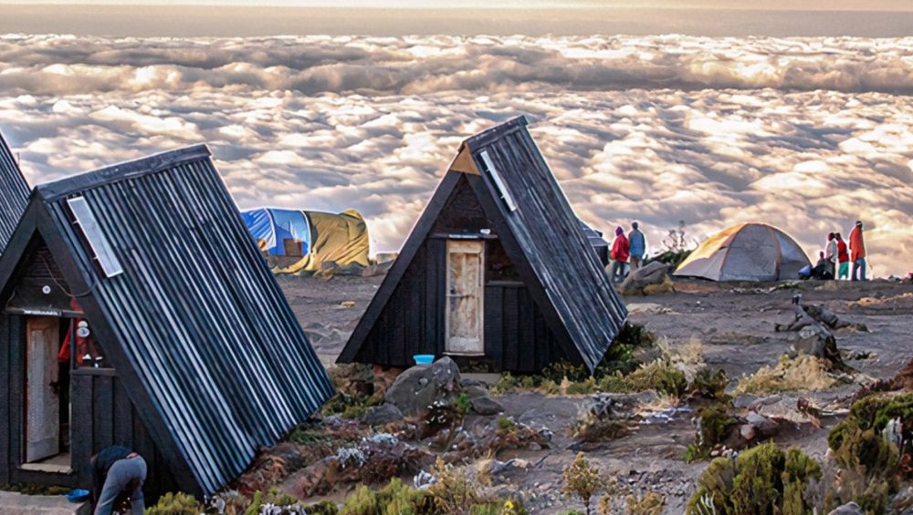
The Machame route is also known as the Whiskey route, given its reputation for being a tough climb, in contrast to the easier Marangu route, which is known as the Coca Cola route. Unlike the gradual incline and hut accomodations found on the Marangu Route, the climbers on Machame hike steeper trails, for longer distances, while sleeping in tents.
The Machame Route climb can be done in a minimum of six days (five nights) on the mountain. However, it is most often tackled over seven days (six nights), for a better altitude acclimatization schedule. The trek begins at Machame Gate, located in the southern base of mountain, within its lush, fertile rainforest.
The route heads toward the Shira Plateau, before circling along the southern circuit halfway around the mountain, exposing the climber to great views from all angles. The approach to the summit is made from the east, and the descent follows the Mweka trail.

Mount Kilimanjaro
Elevation 5895m
Location Tanzania, Africa
Number of Climbers 25,000 Annually

DAY 1
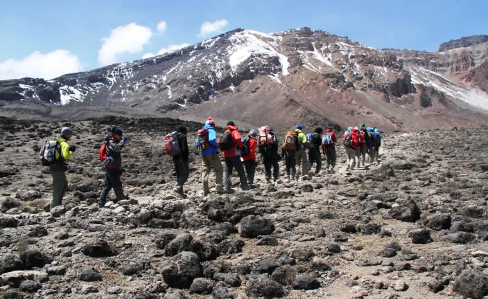
A one hour drive from Moshi lays to the Machame route, where we complete park formalities, meet our crew of porters and start to climb! The first section of the route climbs steadily and involves real jungle bashing through magnificent forest. This path is less well-trodden and it is often wet and muddy underfoot. We camp at Machame camp 3100 m

Trekking Time:4-6 hours /Distance: 9 km / Altitude gain: 1210 m

DAY 2
The route continues on up through the forest until we are the steep ascent on the Shira Plateau, where are rewarding view of the mountain. Looking back, you will be able to see Mt. Meru rising high above Arusha town. We camp at Shira caves at 3840 m

Trekking Time: 4-6 hours / Distance: 9 km / Altitude gain: 740m

DAY 3
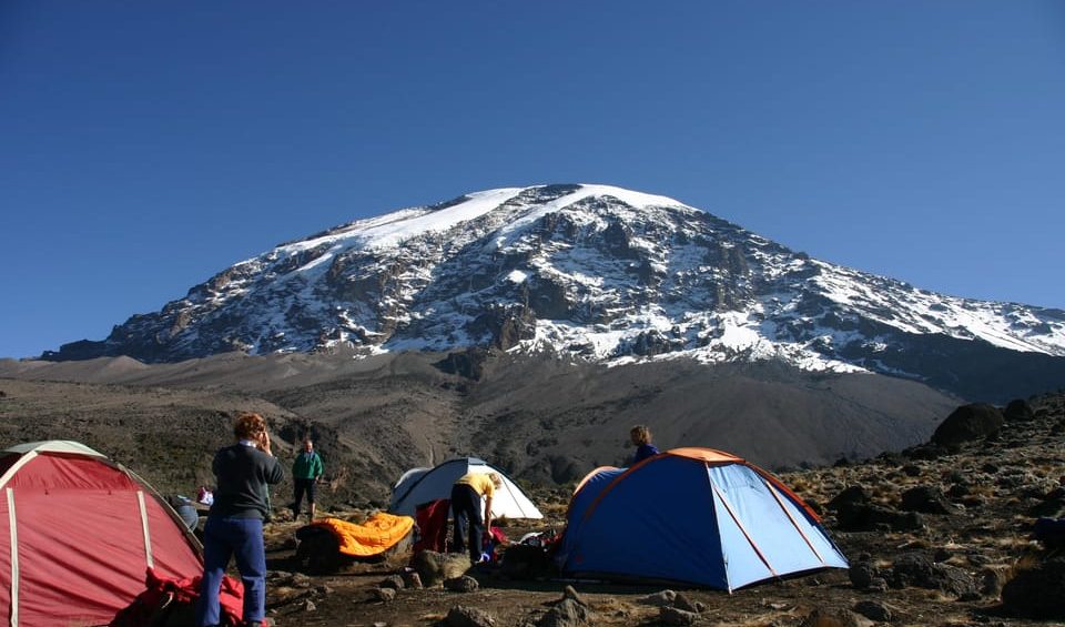
Walking now on high moorland, the landscape changes the entire character of the trek. We traverse the south west side of Kilimanjaro, passing underneath the Lava Tower and the final section of the Western Breach and finally reach camp at Baranco camp 3900m the day has been spent at altitude up to 4600m, but we have followed the mountaineering code of walk high sleep low to avoid altitude sickness by aiding our bodies in acclimatization.

Trekking Time: 6-7 hours /Distance: 15km/ Altitude gain: 700m

DAY 4
We start the day by descending into the start of the Great Barranco, a huge ravine. We exit steeply, up what has been termed the breakfast Wall which divides us from the southeastern slopes of Kibo. Its is a climb over rocks ,not technical but long and tiring. Passing underneath the Heim and Kersten glaciers, we head towards the Karanga Valley 4000 m for lunch.

After lunch we continue the short hike on terrain formed by scree. We walk through arid and desolate land towards Barafu camp 4600 m

Trekking Time: 5-7 hours /Distance: 9 km /Altitude Gain: 700m /Altitude Loss 700 m

DAY 5
We avoid walking too long in the heat of the sun today by starting midnight steeply upwards to the summit glaciers. You will be climb scree for 5 hours, but gain incredible height over a short distance. The views of the spectacular ice cliffs within the crater rim at Stell Point 5750 m as the first rays of the sun emerge are amazing. Spectacular ice cliffs within the crater surround us and the views to Mawenzi peak and beyond are breathtaking. Another hours walk takes us to our goal, the summit of Uhuru 5895 the highest point, Uhuru means freedom in swahili.

Trekking Time: 6-8 hours / Distance: 7 km / Altitude Loss: 1296 m

We begin the descent by returning to Stella Point and then descending on scree slopes back to Barafu camp for breafast and rest before finally heading down to Millenium Camp 3800 for a well-earned rest. On our descent we have fabolous views of the plains and Mawenzi peak.

Trekking Time: 6-14 hours /Distance: 12km / Altitude Loss:2896 m

DAY 6
A gentle trek takes us down through the rainforest to the Mweka Gate 1640 m where we complete park formalities, are met by our vehicles,receive your certificate of ascent courtesy of the earned shower and a cold beer or two

Trekking Time 4-5 hours / Distance:10 km /Altitude Loss: 1360 m

Rongai Route

The Rongai route is the only route that approaches Kilimanjaro from the north, close to the Kenyan border. Though gaining popularity amongst climbers, Rongai has low traffic. It is the preferred route for those looking for an alternative to the crowded Marangu route, for those who would like a more remote hike, and for those who are climbing during the rainy season (the north side receives less precipitation).
The minimum number of days required for this route is six days, and seven days are recommended. Although the scenery is not as varied as the western routes, Rongai makes up for this by passing through true wilderness areas for days before joining the Marangu route at Kibo camp. This route descends down the Marangu route. Rongai is a moderately difficult route, and is highly recommended, especially for those with less backpacking experience.

Mount Kilimanjaro​
Elevation 5895m
Location Tanzania, Africa
Number of Climbers 25,000 Annually

Day 1:
We will pick you up from your hotel in Arusha at 08:00 and drive to the Marangu Gate to obtain permits and clearance. Depart from Marangu and drive to Rongai Gate (1,800 M) where you begin your trek of 3-4 hours today, ascending to Cave Camp at 2,750 M. for dinner and overnight.
Meal Plan: {L, D}

Day 2:
Today you will trek 3-4 hours again before reaching the Kikelewa Camp at 3,500 M. where you will have dinner and overnight.
Meal Plan: {B, L, D}

Day 3:
Hike to Tarn Hut camp today where you will overnight at 3,850 M.
Meal Plan: {B, L, D}.

Day 4:
You will trek to Kibo Hut today, about 4-5 hours, 4,700 M, from where you will begin your ascent to the summit.
Meal Plan: {B, L, D}

Day 5:
Shortly after midnight, you will arise to begin your ascent to the summit, reaching Uhuru Peak by sunrise. You will descend to Horombo Camp for dinner and overnight, 3,820 M..
Meal Plan: {B, L, D}

Day 6:
After breakfast, depart Horombo Camp and descend to the Marangu Gate in about 5-6 hours to collect your certificate and be met by the vehicle to return to your hotel. .
Meal Plan: {L, D}

Umbwe Route

The Umbwe route is a short, steep and direct route. It is considered to be very difficult and is the most challenging way up Mount Kilimanjaro. Due to the quick ascent, Umbwe does not provide the necessary stages for altitude acclimatisation. Although the traffic on this route is very low, the chances of success are also low. The route is offered at a minimum of six days, though seven days is recommended when attempting this route.
The Umbwe route should only be attempted by those who are very strong hikers and are confident in their ability to acclimatize. However, overall, the Umbwe route is not recommended and we discourage its usage for our clients.

Mount Kilimanjaro
Elevation 5895m
Location Tanzania, Africa
Number of Climbers 25,000 Annually

Day 1 Moshi (915 m/3,000 ft)
Arrive at the Kilimanjaro International Airport. You will be met at the airport and transferred to Kindoroko hotel in Moshi town for your overnight.

Day 1 Moshi (915 m/3,000 ft) to Umbwe Gate (1,800 m/5,905 ft) to Umbwe Camp (2,800 m/9,190 ft) 8 km, 5-7 hours Montane Forest
Your day starts early with a briefing, followed by breakfast and an hour drive from Moshi to Umbwe Village (1,490 m/4,890 ft) where your guides and porters pack your equipment and supplies, and give you a lunch pack. You start your ascent at the small Umbwe Gate just above the village and follow a gentle winding vehicle track for an hour to a signboard that announces the small steep Umbwe trail. The introduction is over, and you now climb up for several hours through a dense forest of rubber trees and giant fig trees. In places, you must scamper up steep sections of roots and rock. The Umbwe Camp is in the forest, and there are some caves nearby. You will be greeted here with a graciously served hot meal.

Day 2 Umbwe Camp (2,800 m/9,190 ft) to Barranco Camp (3,900 m/12,800 ft) 8 km, 4-5 hours Semi-Desert
Your day starts early with a steaming cup of tea or coffee. After breakfast, you will climb steeply through thinning forest glades to Giant Erica, Heather, and drier air. You continue up a ridge that drops steeply on both sides, and hopefully, the clouds will part to reward you with a view of Uhuru Peak looming overhead. After lunch, you enter a zone of giant groundsels (Scenario Kilimanjaro) that seem to guard the heights, and this garden is one of Kilimanjaro’s special treasures.

Day 3 Barranco Camp (3,900 m/12,800 ft) to Karanga Camp (4,200 m/13,780 ft) 7 km, 4 hours Alpine Desert
After breakfast, we continue up a steep ridge to the great Barranco Wall, and then you climb this imposing obstacle, which turns out to be easier than it looks. Topping out just below the Heim Glacier, you can now appreciate just how beautiful Kilimanjaro really is. With Kibo’s glaciers soaring overhead, you descend into the lush Karanga Valley to the Karanga Valley campsite. From the camp, you can look east and see the jagged peaks of Mawenzi jutting into the African sky. After a hot lunch in camp, your afternoon is at leisure for resting or exploring. This short day is very important for your acclimatization, since your summit push is about to start. Scramble easily to the top of the Great Barranco and then a traverse over screes and ridges to the Karanga Valley campsite (3h, 4000m.), beneath the icefalls of the Southern Glaciers.

Day 4 Karanga Camp (4,200 m/13,780 ft) to Barafu Camp (4,550 m/14,930 ft) 13 km, 8 hours Alpine Desert
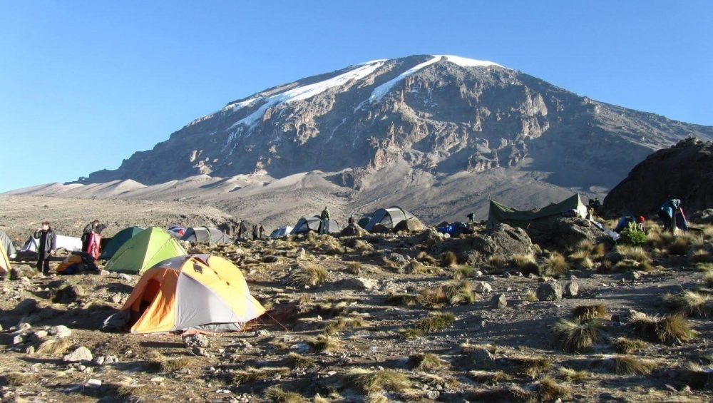
In the morning, you hike east over intervening ridges and valleys to join the Mweka Route, which will be your descent route. Turn left toward the mountain and hike up the ridge through a sparse landscape for another hour to the Barafu Hut where you will receive a hot lunch. The last water on the route is in the Karanga Valley; there is no water at Barafu Camp, even though Barafu is the Swahili word for The famous snows of Kilimanjaro are far above Barafu Camp near the summit of the mountain. Your tent will be pitched on a narrow, stony, wind-swept ridge, so make sure that you familiarize yourself with the terrain before dark to avoid any accidents. Prepare your equipment and warm clothing for your summit climb, and drink a lot of fluids. After an early dinner, go to bed for a few hours of precious sleep.

Day 5 Summit Day! Barafu Camp (4,550 m/14,930 ft) to Uhuru Peak (5,895 m/19,340 ft) to Mweka Camp (3,100 m/10,170 ft) 7 km up, 23 km down 8 hours up, 7-8 hours down scree and seasonal snow
You will rise around 11:30 PM, and after some steaming tea and biscuits, you shuffle off into the night. Your 6-hour climb northwest up through heavy scree between the Rebmann and Ratzel glaciers to Stella Point on the crater rim is the most challenging part of the route for most climbers. At Stella Point (5,685 m/18,650 ft) you stop for a short rest and a chance to see a supremely sanguine sunrise. At Stella Point you join the top part of the Marangu Route, but do not stop here too long, as it will be extremely difficult to start again due to cold and fatigue. Depending on the season and recent storms, you may encounter snow on your remaining hike along the rim to Uhuru Peak. On the summit, you can enjoy your accomplishment and know that you are creating a day that you will remember for the rest of your life. After your 3-hour descent from the summit back to Barafu Camp, you will have a well-earned but short rest, collect your gear, and hike down a rock and scree path into the moorland and eventually into the forest to Mweka Camp (3,100 m/10,170 ft). This camp is in the upper forest, so you can expect mist or rain in the late afternoon. Dinner, and washing water will be prepared, and the camp office sells drinking water, soft drinks, chocolates, and beer!

Day 6 Mweka Camp (3​,100 m/10,170 ft) to Mweka Gate (1,980 m/6,500 ft) to Moshi (890 m/2,920 ft) 15 km, 3 hours Forest
After a well-deserved breakfast, it is a short, scenic, 3-hour hike back to the park gate. Don’t give your porters any tips until you and all your gear have reached the gate safely, but do remember to tip your staff at the gate. At Mweka Gate, you can sign your name and add details in a register. This is also where successful climbers receive their summit certificates. Climbers who reached Stella Point are issued green certificates and those who reached Uhuru Peak receive gold certificates. From the Mweka Gate, our pickup and transfer team will take you back to Kindoroko hotel in Moshi town for an overdue shower and comfortable night.

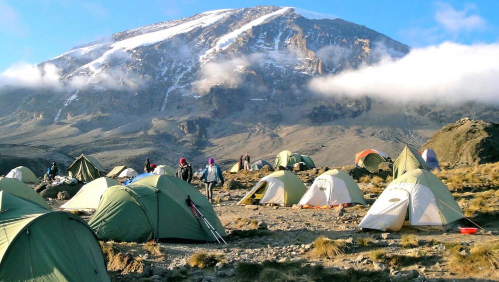
LONDROSI ROUTE

The Shira Route is a little used trail that begins near Shira Ridge. It is nearly identical to the Lemosho route. In fact, Shira was the original route and Lemosho is the improved variation. Although Shira is a varied and beautiful route, it is less favorable than its successor due to the relatively high altitude of Shira’s starting point, which is accessed quickly by vehicle. It is possible that climbers will experience some altitude related symptoms on the first day while camping at 11,800 feet.
The route approaches Mount Kilimanjaro from the west, beginning with a long drive from Moshi to Shira Ridge. The vehicle bypasses the rain forest zone and the hiking trail begins on Shira Ridge. The Shira route crosses the entire Shira Plateau from west to east in a pleasant, relatively flat hike. Then the route traverses underneath Kilimanjaro’s Southern Ice Field on a path known as the Southern Circuit before summiting from Barafu. Descent is made via the Mweka route.

Mount Kilimanjaro
Elevation 5895m
Location Tanzania, Africa​
Number of Climbers 25,000 Annually

Day 1

Londorossi gate – Shira camp (3600m)
Hiking time: 3-4 hours
Habitat: Moorland

The day of walking that begins from Londorossi National Park gate (2,250 m.) through farmland and plantations, and continues climbing steadily on a broad track through shrub forest and stands of giant heather to reach the rim of Shira Plateau (3,350 m.) The views across the surrounding plains open out as we climb and the area is home to a variety of game including buffalo. Our first camp is in the centre of the plateau at “Shira One” (3,550 m.) [3-4 hours walking]

Day 2

Shira two camp (3840m)
hiking time: 5-6 hours
estimated distance: 5km

After breakfast continue hike east across the Shira Plateau past the Shira Cathedral towards Shira Two camp. We only gain 700 feet in elevation – this allows us to acclimatize slowly to the altitude. The views of the plateau are nothing less than spectacular. Overnight at Shira two camp 3850m

Day 3

Barranco (3950m)
Hiking time: 5hours
estimated distance: 6km

Today is the last of the “easy days”. It is about a 7-hour superb hike. We pass the Lava Tower, around the southern flank of Kibo, and slowly descend into the spectacular Barranco Valley, interspersed with giant lobelia and senecia plants. After arriving at our most spectacular campsite, everyone stands in awe at the foot of Kibo Peak, looming high above, on our left. Our camp is only 465 feet higher than where we were last night, but during the day, we will have climbed to just over 14,000 feet. This is one of our most valuable days for acclimatization.

Day 4

Karanga Valley (4000m)
Hiking time: 4 hours
estimated distance: 4km
On the eastern side of the valley, across the stream is the Barranco Wall – a 950 ft. barrier of volcanic rock. Although it is tall and looks steep, it is very easy to climb. This is our first challenge of the day. The views from the wall are nothing less than magnificent. The rest of the day is spent skirting the base of Kibo peak over our left shoulder. We descend down into the Karanga Valley, where we rest up for the night before the tough climb up to Barafu Camp.

Day 5

Barafu (4600m)
Hiking time: 3.5 hours
estimated distance: 4km

First thing, you will be making a steep hike out of the valley. The air starts getting quite thin, and you will be running short of breath. It is a tough, but rewarding uphill to the rocky, craggy slopes at the camp. Barafu means, ice in Swahili, and it is extremely cold at this altitude. So, go to bed early because we will be waking you at midnight for the final leg to Uhuru Peak.

Day6 Summit Uhuru peak (5895m) – Mweka camp (3100m)
Hiking time: 7 hours
estimated distance: 5km

We will start our ascent by torchlight around midnight so that we can be up on the Crater rim by sunrise. The steep climb over loose volcanic scree has some well-graded zig-zags and a slow but steady pace will take us to Stella Point (5,735 m.), in about five or six hours. We will rest there for a short time to enjoy the sunrise over Mawenzi. Those who are still feeling strong can make the two hour round trip from here along the crater rim to Uhuru Peak (5,896 m.), passing close to the spectacular glaciers and ice cliffs that still occupy most of the summit area. The descent to Barafu is surprisingly fast, and after some refreshment, we continue to descend to reach our final campsite (3,800 m.) Millennium. Most of us will be too tired to notice the beauty of the forest surrounding. We spend our last night on the mountain at Mweka Camp.

Day 7

Mweka Camp 3,100 m/10,170 ft to Mweka Gate 1,980 m/6,500 ft to Arusha (890 m/2,920 ft) 15 km, 3 hours Forest

After a deserved strong breakfast it is a short scenic 3-hours hike back to the park gate. Please all tips to porters and guides is given once all crew and the clients gears reached the mweka gate safely, but remember to tip your staff at the gate. At Mweka Gate, you can sign your name and add details in a register. This is also where successful climbers receive their summit certificates. Climbers who reached Stella Point are issued green certificates and those who reached Uhuru Peak receive gold certificates. From the Mweka Gate, you will continue down to the Mweka Village, possibly a muddy, 3 km, 1 hour hike if the road is too muddy for vehicles. In Mweka Village a delicious hot lunch will be served after which you are driven back to Moshi for an overdue hot shower and comfortable night in a nice hotel in Moshi.